Seabed Survey Data Model
Decommissioning
Leading the sharing of international experience and good practice, advocating for risk-based decommissioning policy and guidance
Seabed Survey Data Model
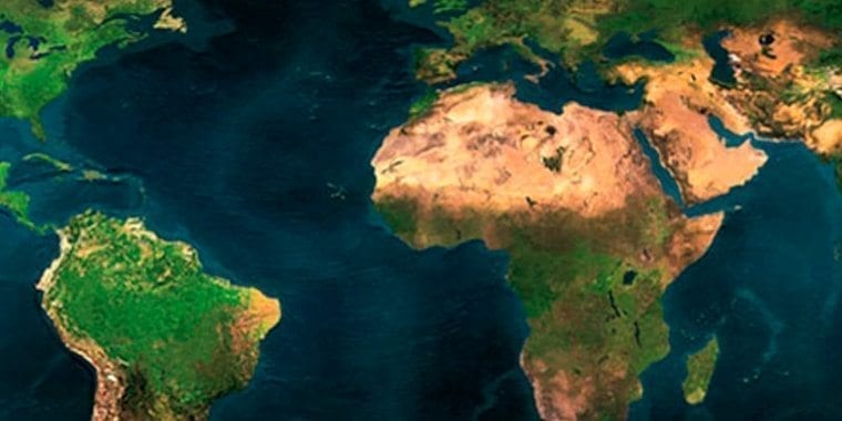
Since its publication in April 2011, the Seabed Survey Data Model (SSDM) has become the de facto industry standard for delivering seabed survey data in geographic information system (GIS) format.
Historically, geographical features interpreted from seabed survey data have been delivered in unstructured CAD files. This has made the management, integration and exchange of the survey data and interpretation of results difficult. To address these issues the IOGP Seabed Survey Data Model (SSDM) Task Force was formed in 2010 to define a standard GIS data model for delivery, management and exchange of seabed survey data. In January 2017 IOGP successfully released an updated version of the model (SSDM V2) incorporating the industry feedback received so far.
Version 2 of the SSDM package may be downloaded here (21 MB). The zip will unpack itself into the following structure:
- 1_Change_Log
- 2_Data_Dictionary
- 3_Data_Model_Templates
- 2a_GIS
- 2b_SeabedML
- 4_Data_Model_Guidelines
- 5_Symbology
- 6_Metadata
- FGDC
- ISO19139
- 7_ Feedback_Form
The IOGP reports supporting SSDM Version 2 are also available directly via the IOGP library:
- Report 462-01 – Guidelines for the use of the Seabed Survey Data Model
- Report 462-02 – Guideline for the delivery of the Seabed Survey Data Model
Other useful documentation:
- Report 462-03 – Interface between pipeline data models and the OGP Seabed Survey Data Model. The Report provides guidance on the interface between the SSDM and the current version of the industry following pipeline data models: Pipeline Open Data Standard Relational (PODS Relational), Pipeline Open Data Standard Esri Spatial (PODS Spatial) and the ArcGIS Pipeline Data Model (APDM).
- The SSDM Version 1 launch presentation (used at ESRI Petroleum User Group in April 2011).
Related content

Efficiency and standardization continue to be key watchwords for the industry as it strives ever harder to deliver low-carbon, safe, and efficient energy sources to the world.

This recent Geomatics Committee publication aims to provide a voluntary standardized approach for the determination of depth or height from seawater pressure observations, a subject for which there is currently no industry-wide technical specification.
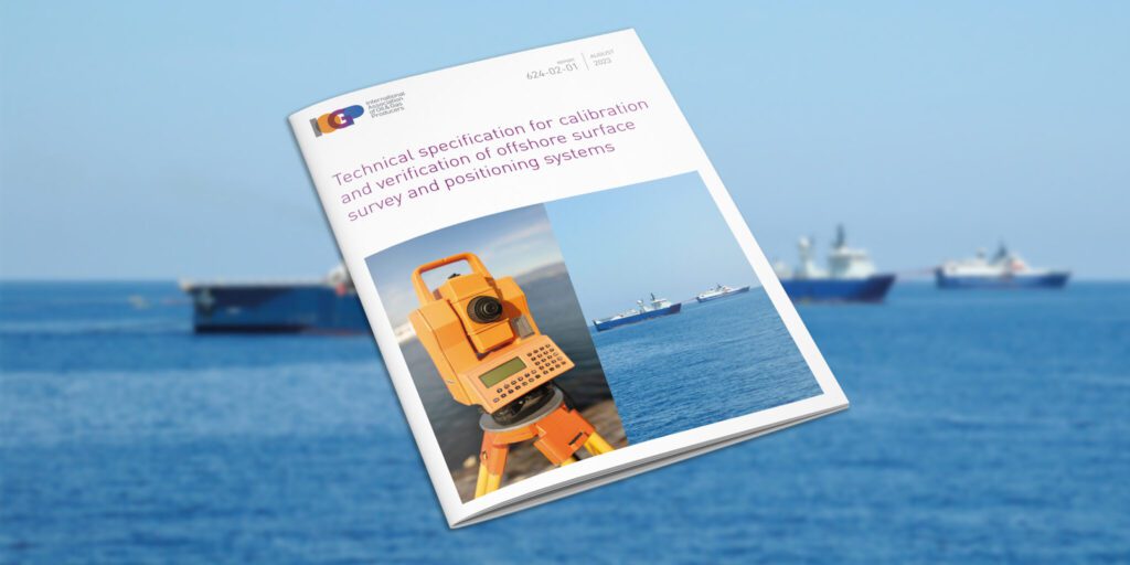
IOGP has released IOGP Report 624-02-01 – Technical specification for calibration and verification of offshore surface survey and positioning systems.

The IOGP Geomatics 11th Industry Day, co-hosted by IOGP, bp, and Shell, highlighted the importance of the geomatics discipline in an ever-evolving industry.

IOGP interviewed Josh Townsend, Chair of IOGP’s GIGS Expert Group, about the GIGS project, its benefits to industry, and its success to date.

(London) IOGP’s Land Survey Data Model (LSDM) is available now. This release continues IOGP Geomatics Committee practice of maintaining an ‘out-of-the-box’ data model template to manage survey data within a geodatabase.
Topographic and other features mapped during land surveys in oil and gas exploration and production are currently collected in a variety of file types and formats.

This year’s IOGP Geomatics Industry Day will focus on the role that Geomatics plays in the energy transition through delivery of cost competitive and operational efficiency and management of HSSE risks and geospatial data solutions as enablers for existing oil and gas and future energy business.

The IOGP Geomatics Committee welcomes Zurinah Yen Puasa of Shell, Vice Chair of IOGP’s Geomatics Committee, as the new Chair. Her experience and knowledge of the industry will help drive growth and give geomatics more influence as we move into the energy transition. We caught up with her to find out more about her experience, this role, and how she plans to help grow geomatics contributions to the industry.

The Geomatics Committee is inviting feedback to better understand the value of the P Formats and Seabed Survey Data Model to its users and IOGP Members. The deadline for responses to both surveys is May 15th – please use the links below if you’d like to participate.

The pivotal role of geomatics in achieving the energy transition was underlined at the IOGP/Petrobras 10th Geomatics Industry Day held on 7-8 December, 2021.

In December, IOGP’s 10th Geomatics Industry Day, organized jointly with Petrobras, attracted over 150 attendees who learned how this discipline is contributing to the energy transition.
The 2021 IOGP / Petrobras 10th Geomatics Industry Day will explore emerging technologies for deepwater survey and geospatial operations, in a low carbon future. It takes place on December 7th-8th.

IOGP has published a new digital GIGS framework.
The energy industry is increasingly aligned with climate action and environmental goals to reduce carbon emissions and the drive to ‘net zero’. Geomatics has a strong part to play in this arena across a multitude of activities.
(London) Efficiency and standardization continue to be key watchwords for the industry as it recovers from the Corona virus epidemic and strives ever-harder to deliver safer, low cost and lower carbon energy sources to the world.

The updated ‘Guidelines for GNSS Positioning in the Oil and Gas Industry’ has been released by the International Association of Oil & Gas Producers (IOGP) as IOGP Report 373-19 and the International Marine Contractors Association (IMCA) as IMCA S 015.

Lucyna (Lucy) Kryla-Straszewska, IOGP Geomatics and Metocean Manager, describes the work of the Geomatics Committee
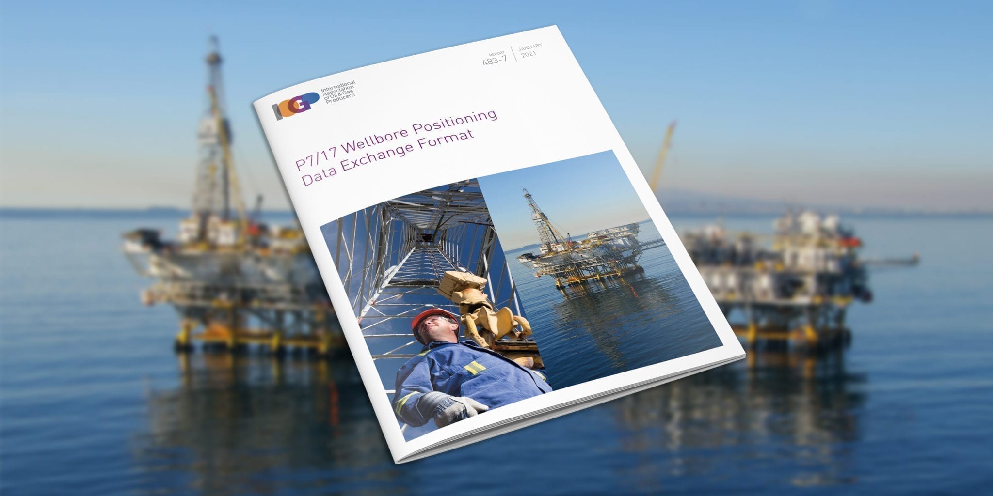
IOGP releases new P7/17 wellbore positioning data exchange format

On the 3rd and 5th November 2020, the Geomatics Committee has delivered two webinars dedicated to IOGP P6/11 Exchange Format. This industry standard is designed for 3D seismic bin grid
The Geomatics Committee is driving improved efficiency in the industry, through common standards for geospatial data management, visualisation & analytics, and in the simplification of survey and positioning operations. This
Spatially-aware applications are at the forefront of the digitalisation revolution, providing the energy industry with new revenue and value-producing opportunities. Geomatics is at the heart of facilitating this revolution and

The ocean is our planet’s largest ecosystem. It stabilizes climate, stores carbon, produces oxygen, nurtures unimaginable biodiversity, and directly supports human wellbeing through food, mineral, and energy resources, as well as providing cultural and recreational opportunities. Unfortunately, much of the ocean is now seriously degraded, and as a responsible sea user, IOGP is working to help the industry play its role as part of the solution.

The new Geomatics Committee Guidance Note 26 (IOGP Report 373-26) describes the recommended practice for the use of coordinate reference systems (CRSs) and coordinate transformations (CTs) between CRSs for the US Gulf of Mexico Outer Continental Shelf (GoM OCS).

IOGP’s Geomatics Committee has elected Frederic Auger of Total as Chair. He succeeds Walter Jardine of BP, who is now serving as a vice-chair.

An upgraded EPSG Geodetic Registry platform could soon describe dynamic coordinate reference systems and derived CRSs which may be used for defining seismic bin grids.

The International Association of Oil and Gas Producers (IOGP) has released version 1.1 of its User Guide for the P1/11 Geophysical position data exchange format.

Throughout, Roel has “stood out as a man of vision and technical aptitude,” says Subcommittee Chairman, Roger Lott. “During his time on the Subcommittee Roel has been instrumental in the

Standardization continues to be a top priority for the Association, supporting improvements in safety, reliability and the integrity of industry operations globally.

IOGP has published an update to the Guidelines, reflecting feedback on use of the original document from regulators from around the world, IOGP member companies, contractors, verification bodies and consultants.

IOGP has released the Geomatics Guidance Note 24 (IOGP Report Number: 373-24), Vertical Data in Oil and Gas Applications.

Richard Wylde and Sigrid Matthes, representing the IOGP Geomatics Committee, delivered two breakout sessions on recent developments in Geomatics standards at this year’s National Data Repository (NDR2017), held at the Norwegian Petroleum Directorate offices in Stavanger, Norway.

The 7th IOGP Industry Day, organised jointly with Statoil at their offices in Stavanger, welcomed some 80 participants representing more than 50 different organisations.

IOGP’s Geomatics Committee is one of the Association’s most active. What exactly does it do, and why does it matter? To find out, Highlights decided to get to the bottom

It is very important for Operators to have an accurate and unequivocal definition of their exploration and operating licence boundaries. This certainty properly defines the commitment area, supports unitisation agreements
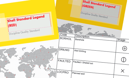
Shell has recently released an updated version of their Shell Standard Legend. The revised version includes new pipeline symbology and an additional symbol set in support of Urban Planning, as


Walter Jardine, BP’s Survey & Positioning Authority, is the new Chair of IOGP’s Geomatics Committee. He previously chaired the Geophysical Operations Subcommittee. Walter has 30 years’ industry experience in providing

In the interests of greater efficiency, lower costs and enhanced reach, IOGP’s Geomatics Committee held its first webinar on 10 March, hosted by Walter Jardine, chair of the Geophysical Operations
Some 100 Geomatics experts gathered in Aberdeen last month for an Industry Day devoted to innovation, efficiency and standardization initiatives. IOGP’s Geomatics Committee collaborated with the International Marine Contractors Association

In the interests of greater efficiency, lower costs and enhanced reach, IOGP’s Geomatics Committee held its first webinar on 10 March, hosted by Walter Jardine, chair of the Geophysical Operations

IOGP has published a revision of IOGP 373-7-3 – Geomatics Guidance Note Number 7, part 3, a multi-part document for users of the EPSG Dataset. Part 3 – the Registry

This April, Aberdeen’s E&P professionals will get a chance to learn about the latest trends in Geomatics at a Geomatics Industry Day, hosted by Shell. The one-day event will take

The IOGP Seabed Survey Data Model Task Force would like to receive industry feedback on SSDM v1. The results will be used to guide development of SSDM v2. If you
In October, IOGP’s Geomatics Committee will be in Houston as part of an industry outreach event for oil and gas industry geomatics professionals and others with an interest in the

In support of the recent upgrade to version V1.1 of the OGP P1/11 and OGP P2/11 position data exchange formats the IOGP Geophysical Operations Subcommittee has published two sample files.

The International Association of Oil and Gas Producers (IOGP) has released version 1.1 of its P1 and P2 geophysical position data exchange formats. Originally released in 2012 to replace the
OGP’s 2014 Geomatics Industry Day will be organised jointly by the Association’s Geomatics Committee and Woodside Energy Ltd. This one-day outreach event will take place at Woodside’s headquarters in Perth, Western

A group of geomatics and well bore positioning specialists is aiming to provide a new format for well bore survey data exchange. The requirement for a format that fully meets
Since its publication in April 2011, the Seabed Survey Data Model (SSDM) Version 1 has become the de facto industry standard for delivering seabed survey data in geographic information system

Image: Participants of the Geomatics Committee’s workshop on geomatic and geodetic challenges in southern Iraq In November, geomatics managers representing eleven oil and gas companies met in Istanbul, Turkey, to
Geomatics Committee gathered in Rio de Janeiro on 21 and 22 October for their biannual committee meeting, hosted by Petrobras, at the company’s CENPES R&D center. This was followed by

OGP’s Geomatics Committee has recently released the P6 Geographic Information Systems (GIS) Data Model to supplement the OGP P6/11 Seismic bin grid data exchange format published in 2012. Since the

Sigrid Matthes is the new Vice Chair of the Geomatics Committee. She joins Chair Palle Jensen in leading the Committees efforts to promote the discipline within the industry. Sigrid says

The Geomatics Committee’s Chair, Palle Jensen of Maersk Oil, is leading the Committee’s efforts within the Geomatics discipline to the benefit of the OGP members and the upstream industr. Palle

OGP’s Geomatics Committee, chaired by Palle Juul Jensen, has recently published a guideline for the delivery of seabed survey data in GIS format in compliance with the OGP Seabed Survey
OGP’s Geomatics Committee has recently produced a revised version of its Guidelines for the conduct of offshore drilling hazard site surveys (Report No 373-18-1). Published in May 2013, the updated

The Management Committee’s recent meeting at OGP’s London offices provided the opportunity to commemorate the efforts of the Geomatics Committee Chair, Richard Wylde, on the occasion of his retirement from


Efficiency and standardization continue to be key watchwords for the industry as it strives ever harder to deliver low-carbon, safe, and efficient energy sources to the world.
This recent Geomatics Committee publication aims to provide a voluntary standardized approach for the determination of depth or height from seawater pressure observations, a subject for which there is currently no industry-wide technical specification.
(London) IOGP’s Land Survey Data Model (LSDM) is available now. This release continues IOGP Geomatics Committee practice of maintaining an ‘out-of-the-box’ data model template to manage survey data within a geodatabase.
(London) Efficiency and standardization continue to be key watchwords for the industry as it recovers from the Corona virus epidemic and strives ever-harder to deliver safer, low cost and lower carbon energy sources to the world.
The updated ‘Guidelines for GNSS Positioning in the Oil and Gas Industry’ has been released by the International Association of Oil & Gas Producers (IOGP) as IOGP Report 373-19 and the International Marine Contractors Association (IMCA) as IMCA S 015.
The International Association of Oil and Gas Producers (IOGP) has released version 1.1 of its User Guide for the P1/11 Geophysical position data exchange format.
Standardization continues to be a top priority for the Association, supporting improvements in safety, reliability and the integrity of industry operations globally.
IOGP has published an update to the Guidelines, reflecting feedback on use of the original document from regulators from around the world, IOGP member companies, contractors, verification bodies and consultants.
IOGP has released the Geomatics Guidance Note 24 (IOGP Report Number: 373-24), Vertical Data in Oil and Gas Applications.
(London) The International Association of Oil and Gas Producers (IOGP) has released version 1.1 of its P6/11 Seismic bin grid data exchange format (IOGP Report Number: 483-6). The P6/11 Format

(London) The IOGP Geomatics Committee’s Seabed Survey Data Model (SSDM) Task Force has completed SSDM version 2 incorporating industry feedback received since the release of SSDM version 1 in April 2011.

(London) A properly-conducted drilling hazard site survey for an offshore drilling location is essential to minimise the risk of harm to personnel and equipment and to protect the natural environment.

The International Association of Oil and Gas Producers (IOGP) has released version 1.1 of its P1 and P2 geophysical position data exchange formats. Originally released in 2012 to replace the
The International Association of Oil & Gas Producers (IOGP) has announced an upgrade to its EPSG online registry of geodetic parameters www.epsg-registry.org. The online registry now includes the facility to

The OGP Geomatics Committee’s Seabed Survey Data Model (SSDM) Task Force has published SeabedML, the Open Geospatial Consortium (OGC) Geography Markup Language (GML) Application Schema for SSDM version 1. OGC
The International Association of Oil and Gas Producers has set up a new body with the goal of increasing the industry’s use of Earth satellite and airborne imagery, a key
Geo-information
Seabed Survey Data Model
Seabed Survey Data Model
P6 Data Model
P6 Data Model
The IOGP P6/11 seismic bin grid data exchange format defines the following parameters for a 3D seismic survey:
- Coordinate Reference System (CRS) and coordinate transformation parameters between global and local geodetic CRSMaster bin grid definition/coverage
- Bin grid origin and increments
- Scale factor of the bin grid
- Nominal bin width
- Full fold definition/coverage
Since the creation of the original P6 format in 1998, Geographic Information System (GIS) has become a common application used by operators to manage, analyse and map geo-information. GIS enables integration of geo-information of which seismic positioning data is an essential component. The requirement to be able to visualize and use seismic bin grid definitions and data in GIS has become increasingly important for:
- Seismic positioning QC (is a bin grid in the correct geographic location relative to surrounding seismic surveys, wells, permits etc?)
- Improved spatial understanding of seismic coverage
- Linking survey outlines to documents to enable map based search for seismic acquisition and processing reports
With this in mind, IOGP has developed a GIS data model for the storage and visualization of seismic bin grid definitions that is based on the new IOGP P6/11 seismic bin grid exchange format.
The P6 GIS Data Model package may be downloaded here. The zip will unpack itself into the following structure:
- 0 – Data dictionary
- 1 – Guidance note – Report 483-6g
- 2 – Data Model template
- 3 – Symbology
- 4 – P6GML
- 5 – Example dataset
- 6 – Presentation
- 7 – Feedback form
Earth Observation
Earth Observation
Geophysical Operations
Geophysical Operations
Surveying and positioning
Surveying and positioning
Geospatial integrity of geoscience software – GIGS
Geospatial integrity of geoscience software – GIGS
GIGS (2021 – coming soon)
GIGS is currently undergoing significant revision and a new version will be released by IOGP in early 2021. Updates in the next release include simplified test series, an online testing platform, enhanced scoring system, consolidated guidance material, modernised and expanded test datasets, as well as bug fixes and error corrections. The new digital GIGS will make it easier to record and review test information and get help when needed. Furthermore, the new release will be more adaptable and flexible to the particular type of application being tested, aligning it with an agile strategy and encourage the use of GIGS in a variety of applicable software and data model development cycles. GIGS will continue to provide a complete and robust quantitative and qualitative evaluation of geospatial integrity and data quality.GIGS is currently undergoing significant revision and a new version will be released by IOGP in early 2021. Updates in the next release include simplified test series, an online testing platform, enhanced scoring system, consolidated guidance material, modernised and expanded test datasets, as well as bug fixes and error corrections. The new digital GIGS will make it easier to record and review test information and get help when needed. Furthermore, the new release will be more adaptable and flexible to the particular type of application being tested, aligning it with an agile strategy and encourage the use of GIGS in a variety of applicable software and data model development cycles. GIGS will continue to provide a complete and robust quantitative and qualitative evaluation of geospatial integrity and data quality (GIGS Poster).
For further information contact Geomatics Manager at lks@iogp.org
GIGS (2011)
The purpose of this Guidance is to provide geoscience software developers and users with recommended industry best practice to evaluate the capabilities of their software with respect to establishing and maintaining geospatial data integrity.
GIGS is a process developed in response to significant concern and user experiences of violations of geospatial integrity of data when using geoscience software, resulting in incorrect results, inconsistent understanding and misleading information for the user community.
The Guidance comprises six items, downloadable below:
- ‘Part 1 – Guidelines’ IOGP report number 430-1, describing the GIGS process. This guidance note is supplemented by a companion MS PowerPoint slide pack (with notes) explaining the GIGS process and business benefits
- ‘Part 2 – Software Review’ IOGP report number 430-2, containing a software review checklist to enable structured testing of geoscience software. This software review document is supplemented by an MS-Excel spreadsheet version (ZIP or RAR) of the checklist, intended to facilitate the execution of a geoscience software review and capture its results
- ‘Part 3 – User guide for the GIGS Test Dataset’ IOGP report number 430-3. This user guide supports a series of data files to be used for testing of the algorithms and data exchange capabilities of the geoscience software. The test dataset is included.
Send your feedback to lks@iogp.org.